
Greater Kansas City · Drone mapping & media
Drone mapping
& 3D models
in Kansas City.
Reel Drone Rangers provides drone mapping, orthomosaic maps, 3D models, and commercial videography for construction sites, land, and businesses across Greater Kansas City. Based in Olathe, Kansas.
The view your project needs
Precision Drone Mapping Built Around Your Goals
Equip your team with a clear, high-resolution visual reference for your property or job site. We align our drone capture plan and final deliverables directly with your project goals to ensure you get exactly the data you need.
 3D MODEL · CONCEPT
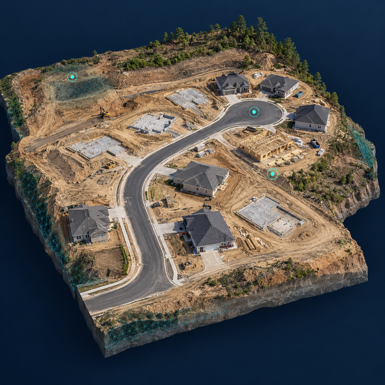
3D Drone Mapping
Explore site features and spatial relationships through a three-dimensional view. Discuss model outputs for project visualization, site documentation, and stakeholder presentations.
Site context · Visual documentationExplore 3D mapping →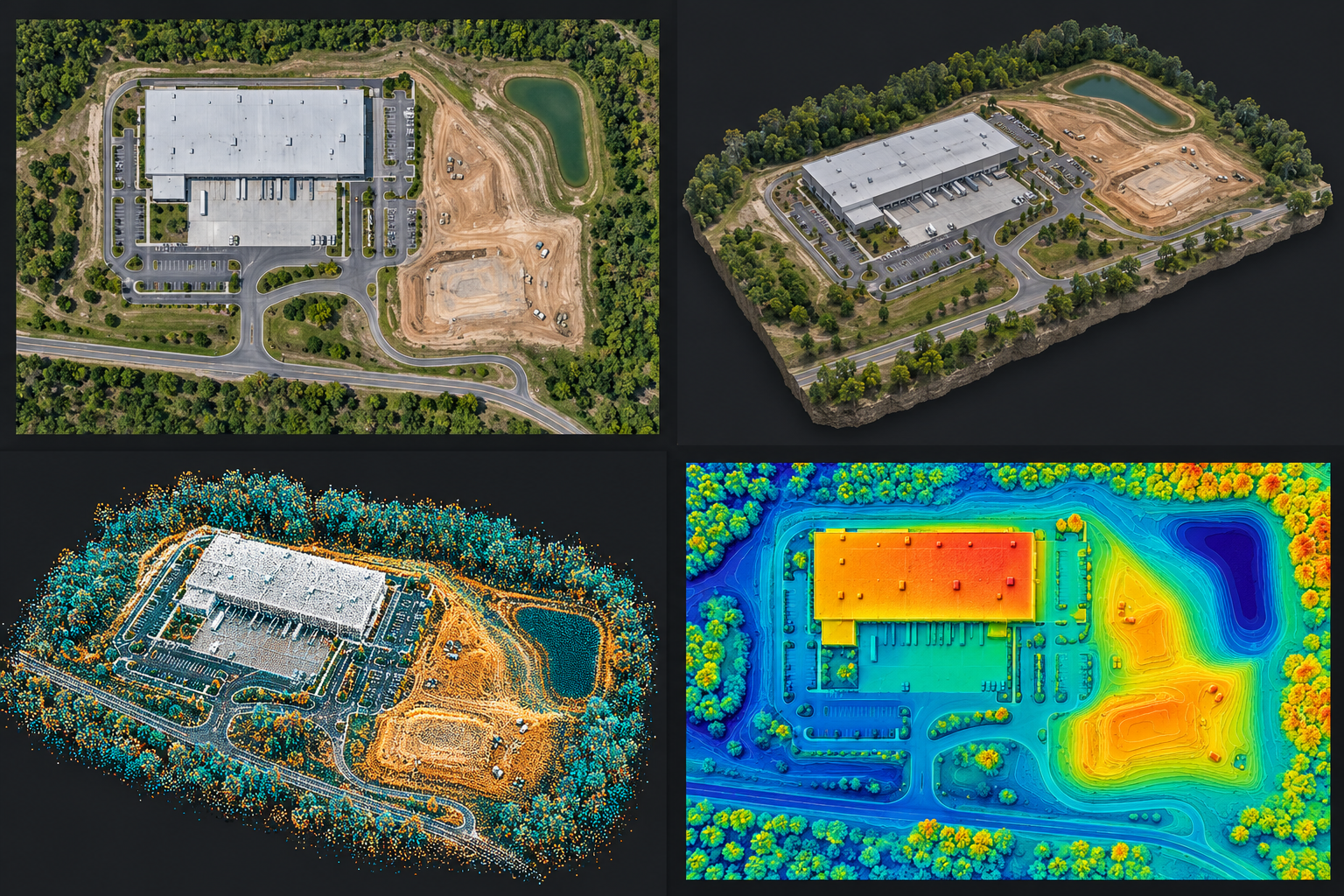 2D ORTHOMOSAIC · CONCEPT
2D Orthomosaic Mapping
Stitch overlapping aerial imagery into a high-resolution, georeferenced overhead view. Create an exact visual record to track site conditions, streamline team coordination, and monitor project progress over time.
Overhead imagery · Site recordsExplore 2D mapping →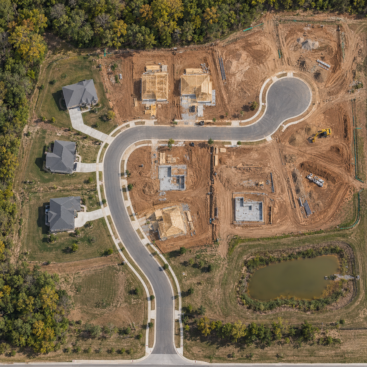 SITE PROGRESS · CONCEPT
Construction Progress
Keep your team informed with consistent aerial viewpoints, repeat site visits, and organized progress imagery. Give stakeholders a clear visual record as work moves forward.
Recurring visits · Progress imageryExplore construction progress →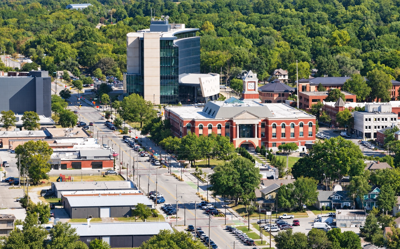 COMMERCIAL AERIAL VIEW
Commercial Drone Videography
Show the scale and story of your business, property, or development with cinematic aerial footage and edited video for websites, presentations, and marketing campaigns.
Brand films · Property & project videoView commercial video pricing →FPV / IMMERSIVE VIDEO
Let your audience
step inside.
Show how a space feels, flows, and connects with an FPV drone fly-through. Bring interiors and exterior surroundings together in an immersive video for property showcases, business websites, and marketing.
Have a space you want people to experience? Share your location, the route you have in mind, and how you plan to use the video. We’ll confirm the capture plan and quote.
Plan an FPV fly-through ↗Explore the outputs
One site.
Different perspectives.
See how 2D and 3D mapping can present a place in different ways. These concept illustrations explain common output types; project deliverables and available formats are confirmed during scoping.
01 / OVERHEAD CONTEXT
2D Orthomosaic
A detailed, stitched overhead image that brings the site into one view. Useful for visual records, property context, and project coordination.
02 / SHAPE + TEXTURE
Textured 3D Model
A three-dimensional representation with photographic texture. View buildings, terrain, and site features from an oblique perspective.
03 / SPATIAL STRUCTURE
3D Point Cloud
A collection of individual points representing visible surfaces in three dimensions. A different way to visualize the structure of a site.
04 / SURFACE HEIGHT
Surface Elevation Map
Color represents relative surface height, including buildings and vegetation. Helps explain elevation patterns; this is not a bare-earth terrain survey.
AI-generated educational illustrations · Not client projects or measured mapping data
Applications
From ground
conditions to
the bigger picture.
A useful deliverable starts with a useful question. Tell us what your team needs to see, document, or communicate.
Let’s define your project ↗Construction & developmentDocument visible site conditions and communicate project progress with consistent aerial perspectives.
Commercial property & landShow property layout, surrounding context, and the relationship between site features.
Businesses & marketing teamsTurn your location, work, and story into compelling commercial video.
Our process
Clear scope. Purposeful capture.
Useful delivery.
01 / Define
Start with the outcome
Share the location, intended use, timeline, and outputs you need. We agree on the project scope before capture.
02 / Capture
Plan the flight
We review site access, airspace, weather, and capture requirements, then coordinate a suitable flight window.
03 / Deliver
Put the view to work
Receive the agreed mapping or media package, with delivery formats and timing established for your project.
Before we fly
Your project,
your questions.
What is the difference between a 3D model and an orthomosaic?
A 3D model shows shape and spatial relationships. An orthomosaic combines aerial images into an overhead view. The right choice depends on how you plan to use the result.
What should I include in a quote request?
Send the site address, approximate acreage, intended use, requested deliverables, and preferred deadline. For video, include where it will be shown and the story you want to tell.
What accuracy and file formats can I expect?
Accuracy requirements, capture methods, and output formats are defined during scoping. Tell us about any measurement, engineering, or survey requirements before booking so we can assess project fit.
Where do you work?
We serve the Greater Kansas City area, including Olathe, Overland Park, Lenexa, and surrounding communities. Contact us about your project location.
The business case
How can drone mapping pay for itself?
A map is useful when it helps your team make a better decision, save time, or avoid an unnecessary expense. Start with the project question—and compare the potential value with the cost of capture and processing.
01 / Fewer repeat trips
Bring the site to the team.
A current overhead view can help answer routine location and progress questions remotely, reducing some return visits. Required inspections and on-site checks still happen.
02 / Faster coordination
Get everyone on the same page.
Use a shared orthomosaic or 3D view to discuss access, work areas, and visible progress. Less time explaining where things are can mean more time moving work forward.
03 / Earlier visibility
Spot questions before they grow.
Repeat captures can reveal visible changes or possible discrepancies worth investigating earlier. Your project team verifies the issue and decides what action is needed.
For recurring documentation, compare monthly value with your monthly package and any mapping or processing add-ons. Visual mapping does not replace a licensed survey, engineering review, or required inspection. Explore DJI’s construction progress workflows ↗
Let’s scope a useful first flight →Straightforward starting rates
Choose the view.
Define the scope.
Start with a clear package, then tailor the coverage and deliverables to your site. Final pricing is confirmed in an itemized estimate before booking.
Orthomosaic Map
From $700
One standard site up to 10 acres. Includes planned aerial image capture, orthomosaic processing, and agreed digital access or export.
Flight $400 + 2D processing $300Mapping + 3D Model
From $1,225
Standard 2D mapping up to 10 acres, plus angled imagery and a processed 3D model of an agreed building or smaller defined area. Full-site 3D coverage is quoted separately.
2D $700 + oblique capture $175 + 3D processing $350Aerial Highlight
From $450
One hour of on-site aerial capture and one edited 30–90 second highlight. Includes color grading, basic branding, music, and one revision.
Capture $200 + highlight edit $250Construction progress documentation
See construction progress photography, deliverables, and visit plans →
$325 per visit · $600/month for 2 visits · $1,100/month for 4 visits
One standard site up to 10 acres, consistent aerial viewpoints, and organized image delivery. Mapping and comparison reports are separate.
Additional mapping coverage: $150 per extra 10 acres or part thereof; extra processing may apply. Mapping deliverables are for visual reference, not certified survey products. Larger sites, expanded 3D areas, specialized outputs, travel, and rush requests are quoted to scope. Applicable taxes and any additional fees are stated in your estimate.
Get an itemized quote ↗Based in Olathe, Kansas
Serving Kansas and Missouri
RDR Aerial Technologies, LLC provides drone mapping, construction progress imagery, and commercial videography for projects across Kansas and Missouri. Orthomosaic imagery gives your team an overhead record of visible site conditions, while a textured 3D model adds spatial context for project discussions and presentations.
From recurring construction progress photos to aerial video for a commercial property, we tailor the capture plan and deliverables to your project. Tell us your site location, acreage, intended use, and preferred deadline. We’ll confirm coverage, scheduling, and any travel costs in your quote.
Explore our drone services · Meet Reel Drone Rangers · Contact us about your project
Start with your site
What do you need
to see more clearly?
Tell us where your project is, what you want to accomplish, and when you need it. We’ll start with the right scope.
Choose the view
your project needs.
2D orthomosaic maps
A shared overhead reference for visible site conditions, planning, and project coordination. Standard mapping from $700.
Explore 2D mapping →3D site models
Textured site visualization for buildings and defined areas. Standard 2D plus defined-area 3D from $1,225.
Explore 3D mapping →Construction progress
Consistent aerial viewpoints and organized image delivery for recurring site updates. Visits from $325.
Explore progress photography →